Sunday morning we ventured north to see La Paz Waterfall and Gardens. This is just south of Poas Volcano in the midst of coffee plantations and cattle grazing on the mountainsides. The park has an impressive aviary where we saw a scarlet macaw, a feisty African grey chasing a blue macaw, amazon parrots, and friendly toucans, among other avian varieties. The frog house boasted an open terrarium which we walked through hunting for native frogs. A kind park employee showed us how to take sharp close-ups, the result of which is the scarlet frog below and my blurry attempt at demonstrating how diminutive that little green guy is. We marched onward toward the falls (5 in all), where we snapped the following self-portrait while standing under the second waterfall.

amy and jorge getting mildly drenched by a waterfall

a mini-frog, finger for scale and to annoy the mini-frog
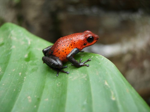
a very poisonous dart frog, which is why i let amy take this picture up close.
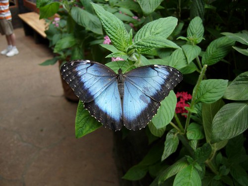
a big morpho butterfly
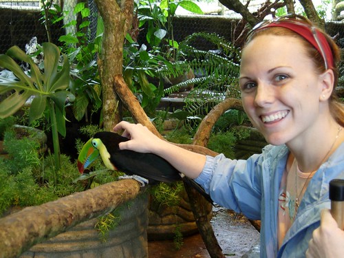
amy pets a toucan. between this and the parrot she has at home, she has officially become the "bird lady."
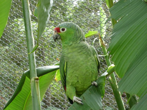
the big version of amy's parrot from home.
a monkey of some sort
a crotch butterfly
(Jorge)
I rented a Daihatsu Terios (pictured below) which is an SUV so small, I am taller than it. I rented it from a German guy in San Jose named Thorsten. Hearing a German guy describe to his partner (Morten) what he wanted from KFC in Spanish with a German accent was unnerving. I thought the USA got into WW2 to prevent these guys from coming across the Pacific. In any case, he gave me a free map and highlighted some preferred roads. The map has red lines for paved roads, broken red lines for dicey paving, and yellow lines for unpaved. He told me to try to avoid the yellow lines, as this is the rainy season and a lot of the unpaved roads can get swamped over when it starts to rain in the afternoon. Amy and I resolved to leave early every morning so that we wouldn’t get caught in the p.m. rainstorms. This resolution was never dutifully kept.
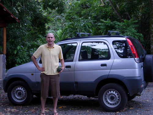
the tiny car i rented. it has four wheel drive and I didn't have to replace the AA batteries even once!
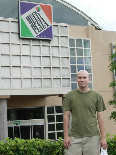
before leaving for our long trek, we stopped at the big mall to get a compass and an itrip. i am not amused by this picture.
On the map below, you can see the 238 km trek from Colon to La Paz Waterfalls (purple), La Paz to Sarchi (light blue), and Sarchi back to Colon (orange). It was on this orange leg that we got lost in Alajuela, a town that is less politically neutral jungle paradise and more East Berlin before the wall came down. It was an ugly, crowded, industrial shanty town where streets would just end for unannounced construction and a maze of one-way streets had us stuck in a vortex. Leave it to a McDonalds sighting to let us know that we had finally returned to civilization on the fringes of San Jose. The tricky part about driving in a country of unnamed streets is that you can follow the signs that point towards the waterfalls and volcanoes to get to your particular attraction, but getting home, you’re on your own. This is why we got lost in Alajuela, and this is why we will get lost again.

waterfalls and home map. click on the map to zoom.
1 comment:
Jorge is a bit curmudgeony in these photos... but I'm sure that is just because of the Eric Estrada sightings he senses are coming in the future...
I'm so glad you two are having so much fun!!
Enjoy, enjoy, enjoy!!
Post a Comment